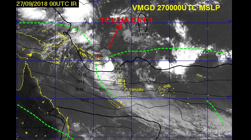
The Vanuatu Meteorology and Geo-Hazards Department (VMGD) in Port Vila, has issued information number 1 on TC Liua this afternoon.
VMGD said the Tropical Cyclone is positioned just north of the top center of the square letter A, number 1 (A,1) of the Vanuatu tropical cyclone tracking map. This is about 640 KM west northwest of Torres. The system is moving west at 2 KM/HR.
The potential for the Tropical Cyclone to move towards northern Vanuatu group in the next 24 to 48 hours is low to moderate.
However, winds close to the center are estimated at 64KM/HR with gusts up to 92KM/HR. The position of the system is expected to be at 11.2S, 161.5E in the next 6 hours.
Gale to storm force winds of 70 to 80 KM/HR are expected about 200 Kilometers (110 nautical miles) within the SE Quadrant.
VMGD stated that heavy rainfalls are expected over northern and central Vanuatu group today, tonight and continuing tomorrow. Flooding is expected over low-lying areas and areas close to the river banks. Seas will be very rough over all open waters of Vanuatu group.
A Severe Weather Warning for heavy rainfalls and possible flooding is current for northern and central Vanuatu, while a Marine Strong Wind Warning is current for all open coastal waters of Vanuatu.
The Vanuatu Meteorology and Geo-Hazards Department said it is closely monitoring the system.