A total of 465 earthquake events ranging from magnitude 2 to 5.8 on the Richter Scale have recorded by the Vanuatu National Seismic Network (VNSN) since Sunday, 14 February.
The Vanuatu Meteorology and Geohazard Department said people on Efate have been experiencing a swarm of earthquakes this week.
At the beginning of the month, there were two seismic swarms recorded in the country.
One of the earthquakes happened South of Matthew and Hunter after a major event that triggered a tsunami, which travelled to the northern islands.
However, the shaking of that earthquake was not felt by the locals and the tsunami did not cause any damage or casualties to any lives.
According to VMDG, the tsunami wave reached the northern parts of the country through the Tide Gauge Stations installed at Lenakel wharf in Tanna, main Port Vila wharf on Efate, Litzlitz wharf on Malekula and Luganville wharf on Santo.
On average, a tsunami wave of about 0.4 meter was recorded.
The department said the swarm of earthquakes does not trigger any major earthquake or tsunami event yet.
However, these earthquakes of magnitude 5 and above, but less than 6.0 can be felt by many, and can sometimes be destructive to humans, infrastructures and the environment depending on their magnitudes and depths.
Earthquake events of magnitude 6.0 and above with shallow depths are likely to produce possible tsunamis in our region.
VMGD confirmed that the ongoing seismic activity clustering to the West of Efate Island, will continue to be felt by everyone in the country, particularly SHEFA Province as an alert and watch for any major earthquake event that could trigger a possible tsunami.
The department said the public must be on alert at all times as the shake of the earthquake will have later impacts as it weakens soil structures, buildings, tree branches, rocks from hillsides or slopes and mountain tops.
The Vanuatu Archipelago is located along the subduction trench where the Vanuatu trench subducts beneath the Indo-Australian plate.
The island arc along with its chain of volcanic islands lies along the Pacific Rim namely the Pacific Ring of Fire.
Along the trench, the seismic activity is always high and it is one of the most active seismic zones in the world.
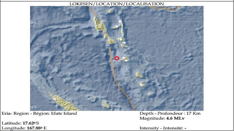
Photo supplied Caption: Latest satellite photo of the earthquake spot this morning (Thursday).